

Wildfires Threaten Nearly One Third of U.S Residents and Buildings
A new approach to calculating wildfire risk shows that more people and places in the U.S. are in harm’s way than previously thought
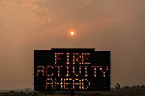
A highway warning sign displays a message while the sun is shrouded in thick wildfire smoke behind it on August 15, 2021 near Lakeview, Oregon.
Mathieu Lewis-Rolland/Getty Images
CLIMATEWIRE | Wildfires threaten nearly one-third of U.S. residents and buildings, according to a new government analysis that suggests the risk is greater than previously known.
The Forest Service, working with Montana researchers, took a new approach to measuring wildfire risk and limited its historical analysis to the 15 years between 2004 and 2018. A previous analysis considered conditions over 34 years ending in 2012.
The narrower and more recent time frame aims to focus on a period during which climate change has notably affected atmospheric conditions and led to intensifying heat, drought and wildfire.
On supporting science journalism
If you’re enjoying this article, consider supporting our award-winning journalism by subscribing. By purchasing a subscription you are helping to ensure the future of impactful stories about the discoveries and ideas shaping our world today.
“We’re more accurately reflecting climate changes that we’ve seen in the last few years,” said Kelly Pohl, associate director at the nonprofit Headwaters Economics, which released the findings with the Forest Service and Pyrologix, a wildfire risk modeling firm.
The Forest Service published its new assessment Wednesday as an update to its risk estimates from 2020. Wildfirerisk.org identifies the most fire-prone parts of the county and helps guide wildfire mitigation efforts.
The updated analysis says more than 115 million people and 48 million buildings are located in counties facing high wildfire risk. Underserved communities are disproportionately exposed.
Nearly 75 percent of tribal area residents are in counties with high wildfire risk. And nearly 20 percent of high-risk counties have a large share of mobile homes, the analysis found.
“This update tells us the nation’s wildfire crisis has the potential to impact more people than we originally thought,” Jeff Marsolais, a Forest Service associate deputy chief, said in a statement.
“That top-level finding is a big deal,” said Pohl. “We really need to be thinking about community-level solutions in lots of parts of the country.”
The update comes as wildfire seasons grow longer, more destructive — and more expensive.
A 2023 analysis by Congress’ joint Economic Committee broadly analyzed wildfire damage including the effect on real estate values, property, watersheds, timber, insurers and more. Wildfires cost the U.S. $394 billion to $893 billion a year, the committee concluded.
Fueling the damage are overgrown forests, development in high-risk areas and rising temperatures, which exacerbate the hot, dry conditions that help wildfires catch and spread.
States, insurance companies and modeling firms are trying to improve wildfire modeling and data to pinpoint where fires might ignite, spread and cause the most devastation.
The information can help decide how to spend billions of dollars that the federal government and some states have provided for mitigation. The bipartisan infrastructure law and the Inflation Reduction Act include about $4 billion combined for “hazardous fuels mitigation.”
The First Street Foundation, a New York nonprofit focused on physical climate risk data, has done its own advanced modeling. The research group unveiled its national fire risk assessment in 2022 that said 26 million U.S. properties faced moderate wildfire risk at the time — and the figure could jump to 35 million by 2052.
Colorado in 2023 overhauled its own outdated fire risk map to account for development in high-risk areas as well as a pine beetle epidemic that left behind 3 million acres of dead, flammable trees. Officials said the changes would help communities prepare for future blazes.
The Forest Service made several changes to its wildfire risk tool in addition to narrowing its modeling to 15 years.
The new version includes updated data about where homes and buildings are located and what types of trees, shrubs and grasses are present on various landscapes. The changes help capture the risk of “low-probability, high-impact events like those that we’ve recently seen in parts of the country, like the Pacific Northwest,” Pohl of Headwaters said. “And we’re better able to represent the way embers can spread wildfires into communities.”
The newly released tool shows that more than 60 percent of the counties in both Oregon and Washington have high wildfire risk, up from 47 percent in the Forest Service’s 2020 estimate.
Wildfirerisk.org now includes features to help communities better understand and respond to wildfire threat.
One example, which Pohl called a “vulnerable populations section,” lets users identify neighborhoods that might struggle to prepare for or respond to wildfire because of demographics. The neighborhoods might have a large number of residents who don’t speak English or don’t have cars. Local officials could decide to translate disaster communications into various languages or adjust emergency evacuation plans.
“These are really helpful resources at the federal level, to think about where risk is greatest across the country,” Pohl said. “But also within a community, to think about the different neighborhoods that might experience wildfire preparation and wildfire recovery differently.”
Reprinted from E&E News with permission from POLITICO, LLC. Copyright 2024. E&E News provides essential news for energy and environment professionals.